Did you know that the IMMA (Important Marine Mammal Area) factsheets from Australia, New Zealand and southeastern Indian Ocean are now published and already being used as a tool to inform planning by government, industry and consultants at the regional and national level in Australia and New Zealand? There are 31 IMMAs across Australia and New Zealand with 24 of those in Australian waters. The IMMA factsheets provide valuable information including a description of the area, justification for the qualifying criteria (i.e., why the area is classified as an IMMA) and supporting information regarding marine mammals that utilise the IMMA based on scientific research.

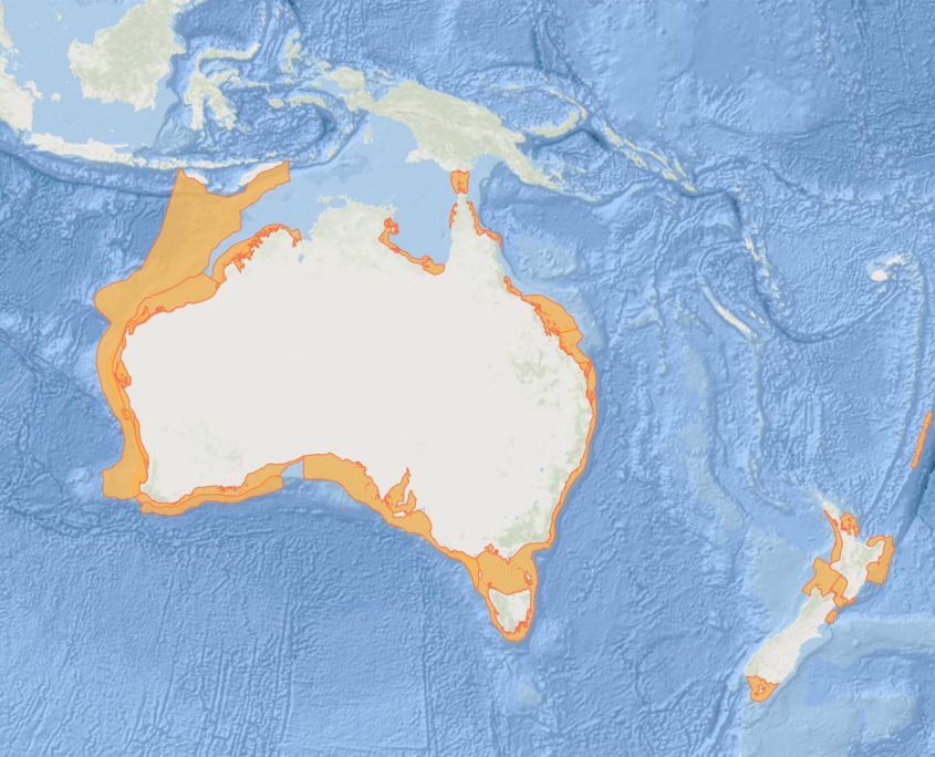
Figure 1: An overview of the IMMAs in the Australia, New Zealand and southeast Indian Ocean Region on the IMMA e-Atlas. By clicking on individual polygons, you can access summary and more detailed information including the fact sheets.
In Australia, the Commonwealth Government typically advises on whether a proponent must go through a ‘approvals process’, during which a project is formally assessed on its potential impacts to the environment. The potential impacts must be submitted, evaluated, and approved before any activity can be undertaken. IMMAs can be useful in this process. Environmental consultants, who undertake impact assessments for industry sector projects such as offshore renewable energy, also now regularly use IMMA maps, data and references.
Daniella Hanf, a Principal Scientist & Marine Fauna Lead at O2 Marine says “The online factsheets and interactive maps are readily accessible and offer a succinct, current and credible summary of whether an area of interest is known to support important mammal species, habitat and behaviour. This is useful during the early stages of impact assessment and management planning as it helps to guide subsequent steps and identify knowledge gaps that need to be addressed. We use the spatial data to generate tailored figures and visualise IMMAs in reference to proposed development areas, which is key to effectively advising clients and communicating with stakeholders, including the public and decision-making authorities.”.
The IMMAs also contribute to the knowledge sources being used to update Biologically Important Areas (BIAs), which are spatially defined areas where aggregations of individuals of a species are known to display biologically important behaviour such as breeding, foraging, resting or migration. BIAs are tools developed by the Commonwealth Government that are used by project proponents and consultants undertaking impact assessments.
“Along with our National tools, such as maps of BIAs, the e-atlas and the factsheets provide additional information that the Government Departments can draw from for spatial planning such as marine park design to determine areas that are important to marine mammals, such as has been done for development of the South Coast Marine Park off Western Australia” says Principal Research Scientist Dr. Kelly Waples from the Western Australian Department of Biodiversity, Conservation, and Attractions.
“The proposed Marine Park overlaps with IMMAs in the region. Therefore, managers and Traditional Owners can utilise the existing information collated in the factsheets on marine mammal population status, distribution, migratory patterns and key foraging and breeding areas to complement Traditional Knowledge and inform the design of the Marine Parks.”

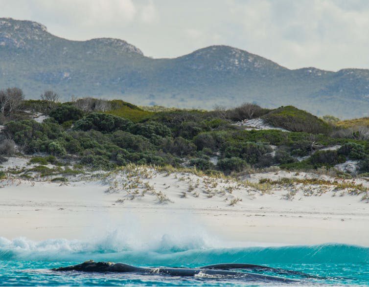
Figure 2: Two southern right whales in shallow waters in the ‘Geographe Bay to Eucla Shelf IMMA’ in south-west Australia. Photo credit: Chandra Salgado Kent.
IMMAs have no legal basis, but they represent a valuable tool developed through an expert peer-reviewed process. Proposed IMMAs (called candidate IMMAs or ‘cIMMAs’) are first developed by marine mammal experts in the region who must present evidence that the identified region meets the criteria required to attain IMMA status. cIMMAs then undergo a critical and stringent independent expert peer review process to ensure that the scientific evidence presented is adequate to support the selection of an IUCN-recognised IMMA in the nominated region. The resulting IMMA maps and factsheets then become publicly available through the IMMA e-Atlas for planners and managers at the regional and national levels to use.
We would love to hear from you (c.salgadokent@ecu.edu.au) if you have used the IMMA Factsheets in your line of work!


